Water data · National expansion underway
Shale Network
Building a national water-quality database for oil- and gas-producing regions.
Our data extend beyond Pennsylvania. We are broadening coverage across the United States, building on records from the northeastern U.S. Marcellus region.
We bring together water-quality records from community groups, agencies, industry, and researchers to support research, teaching, and comparisons across places and dates.
One regional example
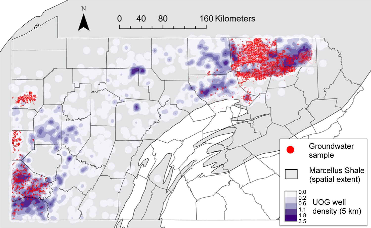
Pennsylvania groundwater dataset, September 2024. This map shows one study, not the database’s full geographic coverage.
Database at a glance
- Sites
- 62,025
- Data values
- 2,109,467
- Data providers
- 515
As of October 20, 2026. Data values are individual analyte results, not independent water samples. Sampling dates, geographic coverage, and available measurements vary among datasets. About the database.
Published datasets
Explore selected releases and the studies that use them. Each dataset page links to its repository record and citation information.
Working with water data
Research
Groundwater and stream-water records support studies of methane, salinity, and water chemistry. Explore published examples.
Teaching
Use water chemistry to investigate methane sources and brine disposal, or practice data analysis in R and Python. Find teaching materials.
Community
The workshop archive brings together agendas, presentations, and discussions from researchers, agencies, industry, and community groups. Browse workshop materials.